Is it mosquito season in North Dakota?
North Dakota's mosquito situation is defined by one word: flooding. The flat Red River Valley — one of the flattest landscapes in North America — drains poorly, and spring snowmelt regularly floods thousands of acres of farmland and wetland simultaneously. The resulting Aedes vexans surges in June can be among the most intense in the United States. West Nile Virus follows in July and August as Culex tarsalis populations build in the warm residual standing water.
The Red River Valley: the floodwater capital
Cass County (Fargo) and Grand Forks County experience legendary mosquito pressure following Red River flooding years. The Valley's pancake-flat topography means that when the river rises, vast areas flood simultaneously. Aedes vexans eggs that have been waiting in floodplain soil hatch explosively, producing populations so dense that they have visibly blackened the sky in historical accounts. Following peak hatch, West Nile Virus builds in the resident Culex tarsalis population through July.
The Missouri River corridor: Bismarck and west
The Missouri River and its tributaries — Heart, Cannonball, Knife rivers — produce their own floodwater events in western North Dakota. Bismarck and Mandan see a compressed but real season from late June through August. Lake Oahe and the Garrison Reservoir system provide stable Culex tarsalis habitat through the summer, driving WNV transmission in some years.
Prairie potholes: the wetland driver
North Dakota sits in the Prairie Pothole Region — a vast mosaic of glacially formed wetlands that stretches into Canada. These potholes provide breeding habitat for dozens of species across the state and make North Dakota ecologically significant for waterfowl and mosquitoes alike. Culex tarsalis abundance and WNV transmission risk are closely tied to pothole water levels in any given year.
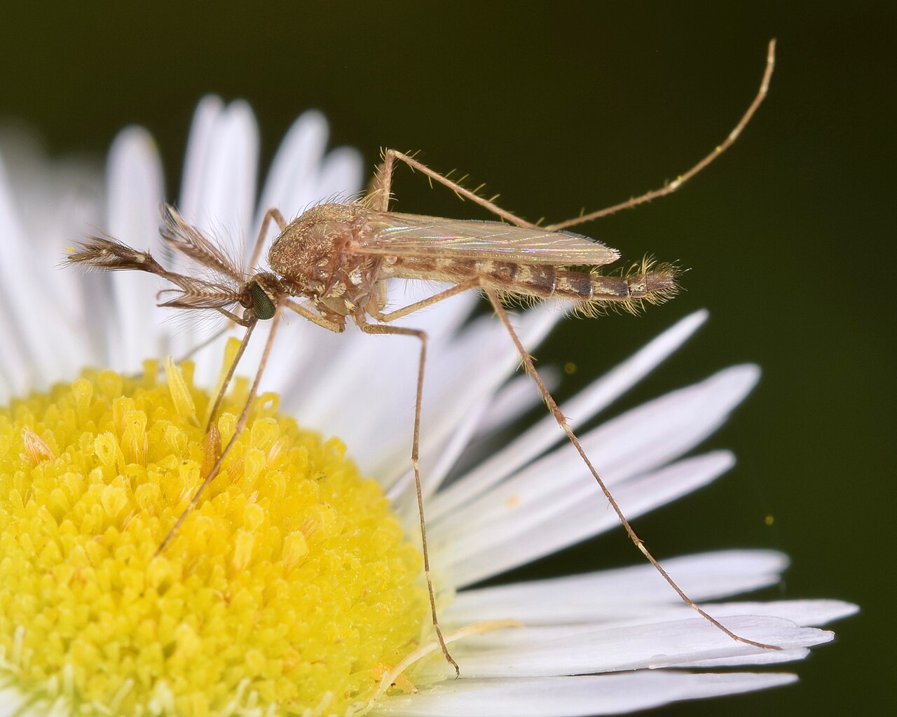
The species behind North Dakota's reputation for legendary spring mosquito emergences. When the Red River floods — and in high-water years it can inundate hundreds of thousands of acres of Cass and Grand Forks County farmland simultaneously — the Aedes vexans eggs waiting in that floodplain soil hatch en masse. The 1997 Red River flood produced one of the most severe mosquito emergences in North Dakota history; the 2009 and 2011 floods repeated the pattern. Populations can increase by orders of magnitude within a week of water recession, producing pressure that makes outdoor activity in the Fargo-Moorhead metro genuinely difficult in June of active years.
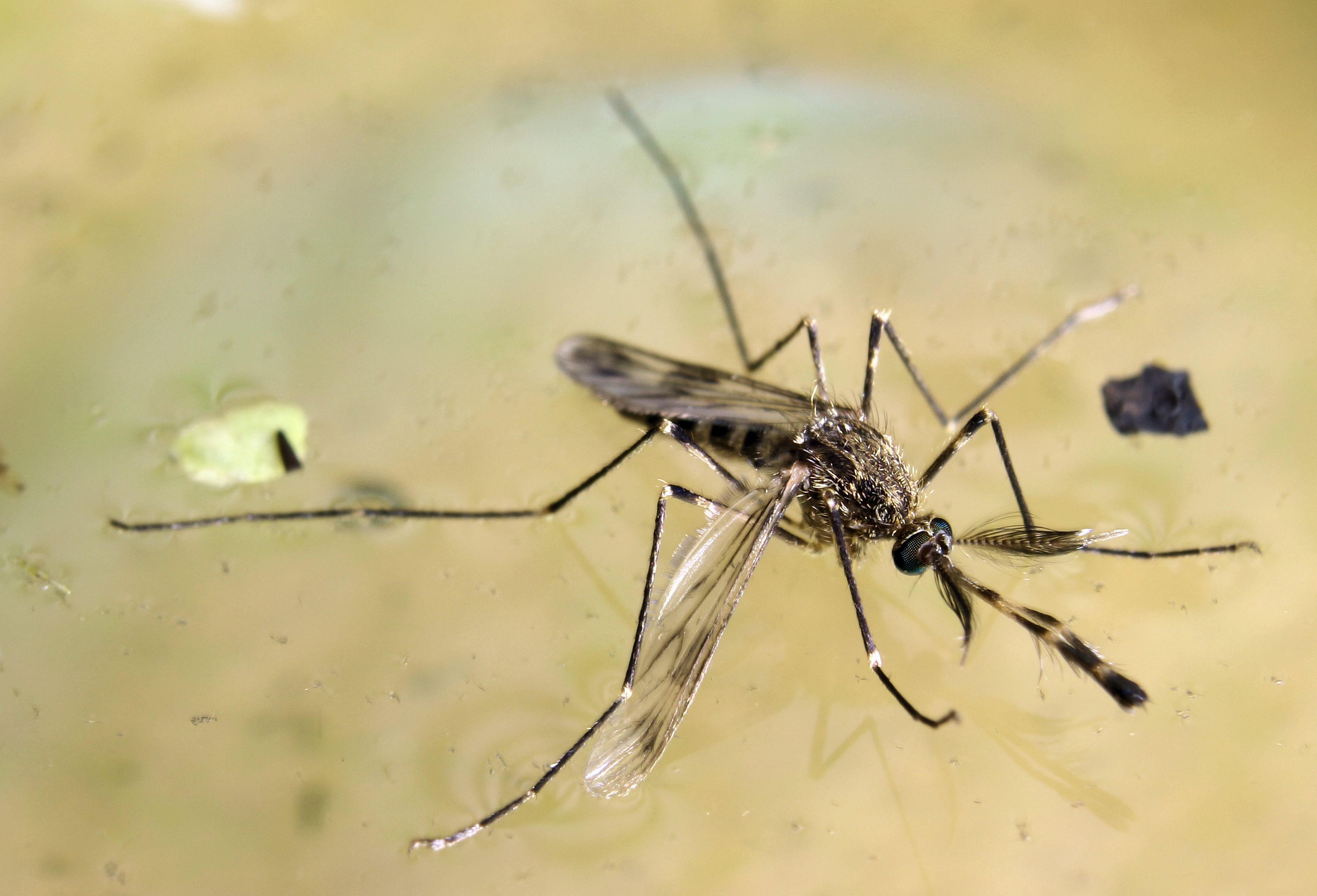
The WNV vector that builds through the summer as floodwater species decline. Culex tarsalis breeds in the warm residual water of North Dakota's prairie potholes — the glacially formed wetlands that cover the eastern half of the state — and in the slow river backwaters and agricultural drainage sumps that persist through July and August. Burleigh County (Bismarck) and Cass County (Fargo) record the state's highest WNV activity. In particularly warm, dry summers, North Dakota has recorded among the nation's highest per-capita WNV rates — the combination of outdoor recreation culture, sparse population, and high tarsalis productivity makes the per-capita number stark.
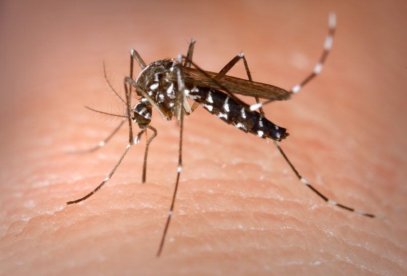
Establishing in southeastern North Dakota, documented in Cass and Richland counties in recent years and advancing northward along the I-29 corridor. Still far less significant in North Dakota than in southern states — the short season and cold winters limit its productivity — but its container-breeding habit and daylight biting behavior make it notable in the Fargo metro. Residents accustomed to mosquitoes only at dusk may be caught off guard by a species that bites throughout the afternoon in residential backyards.
| City | Peak Season | Off-Season | Notes | |
|---|---|---|---|---|
| Fargo | Jun – Aug | Off Sep–May | Red River Valley; most intense flood-surge events; Cass County WNV active most years | Check live |
| Bismarck | Jun – Aug | Off Sep–May | Missouri River corridor; Culex tarsalis; shorter season than Fargo | Check live |
| Grand Forks | Jun – Aug | Off Sep–May | Red River; Grand Forks County; second-worst flood mosquito zone after Fargo | Check live |
| Minot | Jun – Jul | Off Aug–May | Souris River; shorter season; intense June peak after snowmelt | Check live |
| Mandan | Jun – Aug | Off Sep–May | Missouri River; adjacent to Bismarck; Heart River floodplain pressure | Check live |