IsItMosquitoSeasonYet
← National tracker
Oregon · Mosquito Season Guide

Is it mosquito season in Oregon?


Right now Live
···

Check an Oregon city
II. Oregon Mosquito Season Month by month

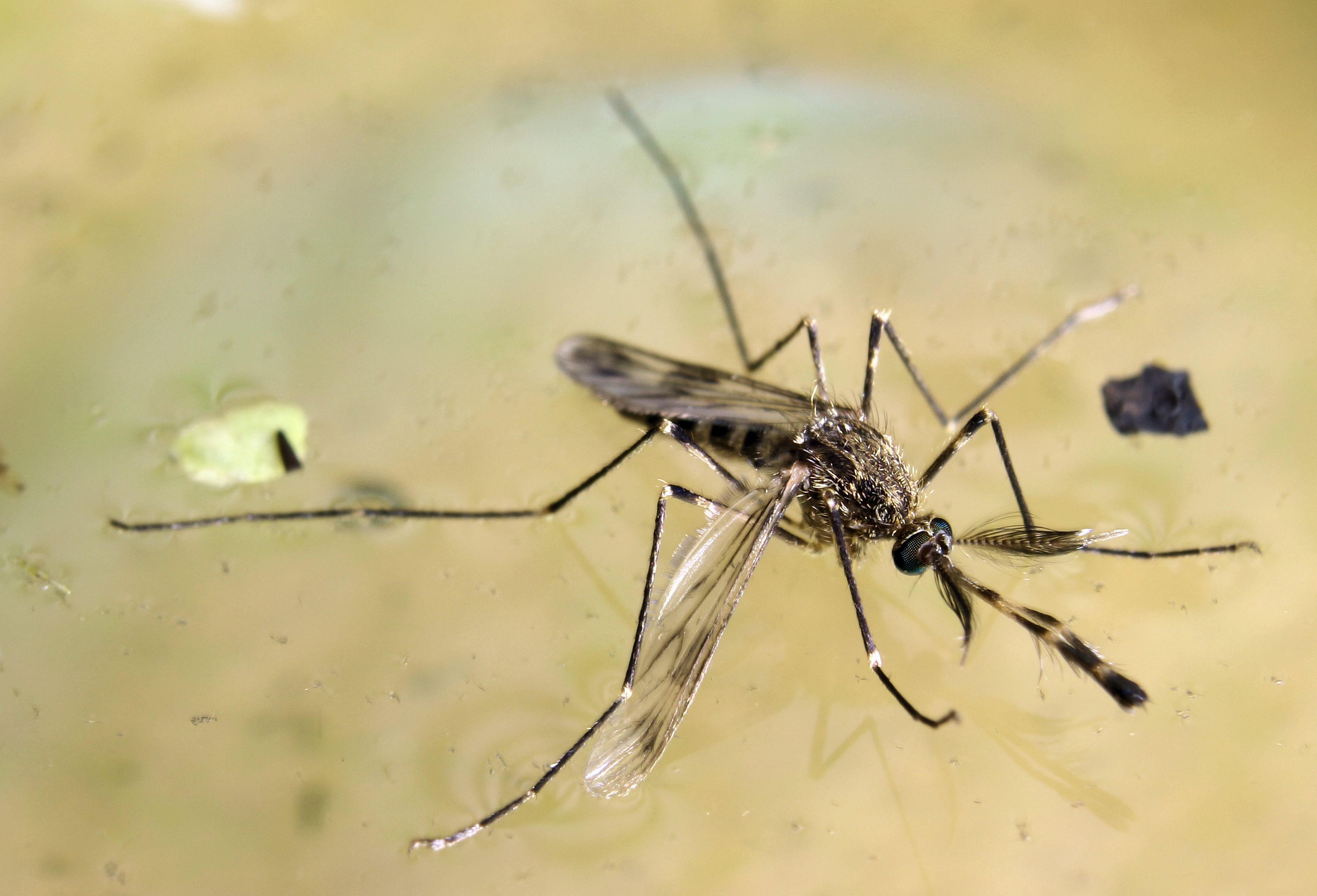
Oregon is a state of two mosquito worlds divided by the Cascades. West of the mountains — Portland, Salem, Eugene — a temperate maritime climate produces a moderate season with limited disease risk. East of the Cascades, the Columbia Basin and Klamath Basin run some of the Pacific Northwest's most active West Nile Virus transmission, driven by Culex tarsalis in the extensive irrigation infrastructure.

Western Oregon / Willamette Valley
Portland · Salem · Eugene
Eastern Oregon / Columbia Basin
Bend · Pendleton · Klamath Falls
Very Low Low Moderate High Very High taller = more active · color = severity
~50
mosquito species recorded in Oregon
Jun–Aug
peak season statewide
WNV
consistently active in eastern Oregon most years
2 zones
wet west vs. dry east — very different risk profiles

Eastern Oregon: the WNV zone

Umatilla, Morrow, and Gilliam counties along the Columbia River are Oregon's most WNV-active counties — a consequence of irrigated agriculture creating vast Culex tarsalis habitat in the otherwise arid landscape. The Columbia Basin Project and the network of irrigation canals sustain large summer populations. Malheur County in the southeast has a similarly active profile driven by the Owyhee Irrigation District and Malheur Lake wetlands.

The Willamette Valley: moderate but real

Portland, Salem, and Eugene experience a genuine but moderate season from May through September. The Willamette River and its tributaries, the extensive wetland mitigation areas throughout the valley, and urban storm drain systems support Culex pipiens and Aedes vexans populations. WNV is detected in the Willamette Valley less consistently than eastern Oregon, but positive pools are found in most years.

The Klamath Basin: a wetland hotspot

The Klamath Basin in south-central Oregon — shared with northern California — is one of the most important waterfowl areas in North America, and that bird density supports significant West Nile Virus amplification in local Culex tarsalis populations. Klamath County has recorded some of the highest WNV positive pool rates in Oregon. The area's managed wetlands for wildlife are simultaneously productive mosquito habitat.

III. Oregon's Key Mosquito Species
Culex tarsalis mosquito photograph
Culex tarsalis
Western Encephalitis Mosquito

East of the Cascades, Culex tarsalis is the dominant story — in the Columbia Basin irrigation districts of Umatilla and Morrow counties, in the Klamath Basin's bird-rich marshes, and along the John Day and Malheur River corridors. Oregon's WNV case geography maps almost exactly onto tarsalis habitat: the dry, irrigated east. Umatilla County has recorded some of the highest WNV rates in the Pacific Northwest during active years, driven by the Columbia Basin Project's extensive canal infrastructure and the warm temperatures that the Cascade rain shadow produces from July through September.

Aedes vexans mosquito photograph
Aedes vexans
Floodwater Mosquito

West of the Cascades, Aedes vexans is the mosquito most Oregonians actually encounter — the species that appears suddenly after the Willamette River rises, fills the valley's wetland mitigation areas, and makes evening walks unpleasant for two weeks before subsiding. Sauvie Island, the Tualatin River National Wildlife Refuge, and the floodplain wetlands south of Portland produce the metro area's most intense floodwater surges. East of the Cascades, Ae. vexans also erupts along the John Day, Malheur, and Owyhee River corridors following spring snowmelt.

Culex pipiens mosquito photograph
Culex pipiens
Northern House Mosquito

The dominant WNV vector in Portland, Salem, Eugene, and the Willamette Valley cities. Culex pipiens breeds in the slow, organically rich water of Portland's aging storm drain system, the wetland mitigation ponds that line the Sunset Highway corridor, and residential containers throughout the valley. A secondary WNV risk compared to tarsalis in the east, but the pipiens population in the Willamette Valley is large enough that WNV circulates in Oregon's most populous corridor every summer — surveillance detections in Multnomah and Washington counties are annual.

IV. Oregon Cities at a Glance
CityPeak SeasonOff-SeasonNotes
Portland May – Sep Off Oct–Apr Willamette River; urban Culex pipiens; moderate WNV risk; Columbia Slough provides habitat Check live
Salem May – Sep Off Oct–Apr Willamette Valley; agricultural drains; similar to Portland but slightly more agricultural Check live
Eugene May – Aug Off Sep–Apr Willamette headwaters; wetter microclimate; shorter effective season than Portland Check live
Bend Jun – Aug Off Sep–May High desert east of Cascades; Deschutes River; Culex tarsalis; lower density than Columbia Basin Check live
Medford May – Sep Off Oct–Apr Rogue Valley; longer season than northern OR; Culex tarsalis active; Bear Creek corridor Check live
More State Guides
Florida Year-round activity in the south — 80+ species including invasive Ae. aegypti and the Asian tiger mosquito across all 67 counties Texas ~85 species across four climate zones — Gulf Coast active March through November, with year-round pressure in the Rio Grande Valley California Central Valley is the #1 West Nile corridor in the US — invasive Ae. aegypti and Ae. albopictus now established in 20+ counties Georgia Atlanta metro leads the Southeast in Asian tiger mosquito density — active statewide March through November New York Ground zero for West Nile in the US (1999 Queens outbreak) — NYC metro and Long Island see the highest Northeast seasonal pressure Illinois Home of the 2002 Cook County West Nile outbreak — the deadliest urban WNV event in US history — peak season June through September Ohio Lake Erie to the Ohio River — WNV active in Franklin and Cuyahoga counties, with floodwater species surging after summer storms Pennsylvania Philadelphia WNV corridor meets rural EEE risk in western PA — the densest human population in the mid-Atlantic mosquito belt Michigan Site of the 2019 EEE outbreak — the deadliest in decades — 10 human cases and 6 deaths concentrated in SW Michigan Great Lakes wetlands New Jersey Oldest organized county mosquito control in the US (1914) — Pine Barrens EEE corridor and fierce salt marsh Shore species Virginia Tidewater season runs April–October — the longest mid-Atlantic window — with the Great Dismal Swamp as an active EEE hotspot North Carolina The coastal plain runs one of the longest seasons in the Southeast — NC leads the nation in La Crosse encephalitis cases from the Appalachian foothills Maryland Chesapeake Bay watershed creates extraordinary mosquito habitat — tidal marshes, Eastern Shore wetlands, and the DC-Baltimore corridor combine for dense seasonal pressure Tennessee Memphis and the Mississippi River corridor historically record the highest WNV case counts in the mid-South — Ae. albopictus has colonized all 95 counties Indiana Indiana sits at the crossroads of the Great Lakes EEE belt — Lake Michigan wetlands in the north and the Wabash River floodplain drive intense seasonal pressure Louisiana The Gulf Coast's most intense pressure — coastal marshes and summer rains keep Cx. quinquefasciatus and Ae. aegypti active from March through November Alabama Mobile Bay to the Tennessee Valley — Ae. albopictus has reached all 67 counties and peak WNV season runs June through September South Carolina Low Country marshes produce some of the Southeast's densest Anopheles and Culex populations — season runs March through November Minnesota 10,000 lakes means 10,000 breeding sites — the Northwoods sees intense but short July–August peaks, while the Twin Cities face a longer June–September window Wisconsin Great Lakes wetlands and the Mississippi River backwaters drive strong WNV pressure in the Milwaukee corridor — peak season July through August Missouri At the confluence of the Missouri and Mississippi rivers — St. Louis historically ranks among the highest WNV cities in the US — season May through October Arkansas Delta rice-field flooding and the Arkansas River bottomlands create some of the highest rural mosquito pressure in the mid-South — active April through October Washington Western WA stays mild and damp year-round; the Yakima Valley and Columbia Basin face the highest WNV risk in the Pacific Northwest — peak July through September Arizona Monsoon season (July–September) drives sudden mosquito explosions across the Valley of the Sun — WNV detected annually Colorado Front Range WNV corridor stretches Denver to Fort Collins — eastern plains carry the state's highest risk Connecticut Connecticut River valley WNV pressure meets EEE risk in inland freshwater wetlands — active May through October Delaware Chesapeake and Delaware Bay marshes create outsized pressure for the nation's second-smallest state Hawaii Year-round activity at sea level — no native species, but Ae. aegypti and tiger mosquitoes established statewide Idaho Snake River Plain irrigation districts fuel summer WNV pressure — season June through September Iowa Mississippi River corridor and prairie wetlands drive intense June–September pressure — WNV active statewide Kansas Great Plains WNV corridor — Wichita and Kansas City see peak pressure July–August; floodwater species surge after storms Kentucky Ohio River corridor and Kentucky Lake wetlands sustain a long April–October season across all 120 counties Maine Short but intense July–August season — EEE detected in some years in the southern coastal plain Massachusetts EEE fatality rate exceeds 30% — the Plymouth County swamp complex is the active epicenter — season May through October Mississippi Gulf Coast near-year-round pressure meets Delta rice-field flooding for one of the South's most intense mosquito environments Montana Yellowstone and Missouri River corridors drive a compressed June–August season — WNV detected most years in eastern MT Nebraska Platte River valley and eastern Nebraska are among the Great Plains' most active WNV zones — peak July–August Nevada Las Vegas monsoon season drives July–September activity; Reno irrigation districts fuel a parallel northern peak New Hampshire EEE detected most years — the southern lakes and coastal plain are in the active Northeast EEE corridor New Mexico Monsoon season (July–September) creates sudden breeding habitat; WNV circulates in the Rio Grande valley annually North Dakota Red River Valley flooding produces some of the Great Plains' most extreme floodwater mosquito events — peak June–August Oklahoma One of the South-Central's most intense seasons — the Arkansas and Red River corridors sustain populations April through October Rhode Island New England's densest coastal pressure — Narragansett Bay salt marshes and WNV active in all five counties South Dakota Missouri River and James River valleys drive summer WNV activity — eastern SD sees the most intense pressure Utah Salt Lake Valley WNV corridor and irrigation districts sustain a July–September peak — drier areas see limited activity Vermont Champlain Valley runs Vermont's longest season — EEE detected in the Lake Champlain lowlands in some years West Virginia Kanawha and Ohio River valleys sustain a May–October season — Ae. albopictus now established statewide Wyoming The shortest meaningful season of any contiguous US state — North Platte valley WNV window is just 6–8 weeks
West Nile, dengue, and EEE: US disease risk by region → Asian tiger mosquitoes: why you're getting bitten during the day → Eliminating standing water: the highest-leverage yard move →