IsItMosquitoSeasonYet
← National tracker
West Virginia · Mosquito Season Guide

Is it mosquito season in West Virginia?


Right now Live
···

Check a West Virginia city
II. West Virginia Mosquito Season Month by month

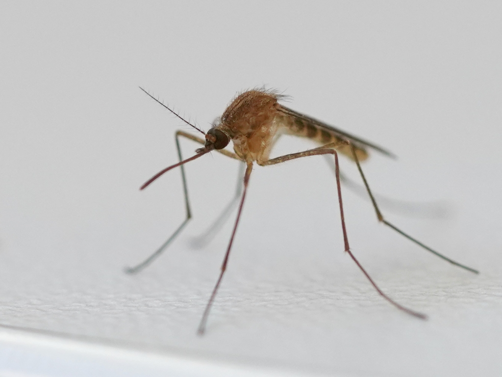
West Virginia's topography is a mosquito map. The state's river valleys — the Ohio, Kanawha, Monongahela, and Greenbrier corridors — concentrate both people and breeding habitat in the same narrow lowlands, while the Allegheny Plateau ridges between them see a fraction of the pressure. The practical result: residents of Parkersburg and Charleston experience a genuine April–October season with consistent West Nile Virus exposure, while someone living at elevation in Pocahontas County has meaningful activity for perhaps eight weeks. Aedes albopictus has now reached all 55 counties — including the mountain ones — extending daytime biting pressure into habitats where Culex species rarely venture.

Charleston / Kanawha Valley
Charleston · Huntington · St. Albans
Northern WV / Ohio River
Morgantown · Parkersburg · Wheeling
Very Low Low Moderate High Very High taller = more active · color = severity
~50
mosquito species recorded in West Virginia
Apr–Oct
active season in the Ohio River valley
55
counties — all with Ae. albopictus established
WNV
detected in northern WV counties annually

The Ohio River valley: WV's most active zone

Wood County (Parkersburg) and Ohio County (Wheeling) experience West Virginia's most consistent West Nile Virus activity. The Ohio River floodplain, the Muskingum and Little Kanawha River backwaters, and urban storm drain systems support significant Culex pipiens populations through July and September. Proximity to Ohio's more active WNV zones amplifies the risk.

The Kanawha Valley: Charleston and the capital region

Charleston and the Kanawha Valley experience a genuine April–October season driven by the Kanawha and Elk River corridors. Culex pipiens is the dominant urban vector, while Aedes albopictus — established statewide — extends daytime biting pressure throughout the suburbs. Cabell County (Huntington) follows a similar pattern influenced by proximity to the Ohio River.

Appalachian headwaters: limited but present

The high-elevation counties of eastern West Virginia — Pocahontas, Randolph, Tucker — see much shorter seasons than the valleys, with meaningful activity only in July and August. The Monongahela National Forest headwater streams provide some habitat, but the altitude and cool nights dramatically reduce both density and disease risk compared to the lowland river corridors.

III. West Virginia's Key Mosquito Species
Culex pipiens mosquito photograph
Culex pipiens
Northern House Mosquito

The primary WNV vector in West Virginia's Ohio River communities — Parkersburg, Huntington, Wheeling — where urban storm drain infrastructure provides dense breeding habitat in a state that otherwise lacks large agricultural water sources for Culex tarsalis. Culex pipiens is essentially a city species in WV: it thrives in the aging combined sewer overflow infrastructure of Ohio River towns and the residential neighborhoods of Charleston and Morgantown. Wood County (Parkersburg) and Cabell County (Huntington) record the state's most consistent WNV detections.

Aedes albopictus mosquito photograph
Aedes albopictus
Asian Tiger Mosquito

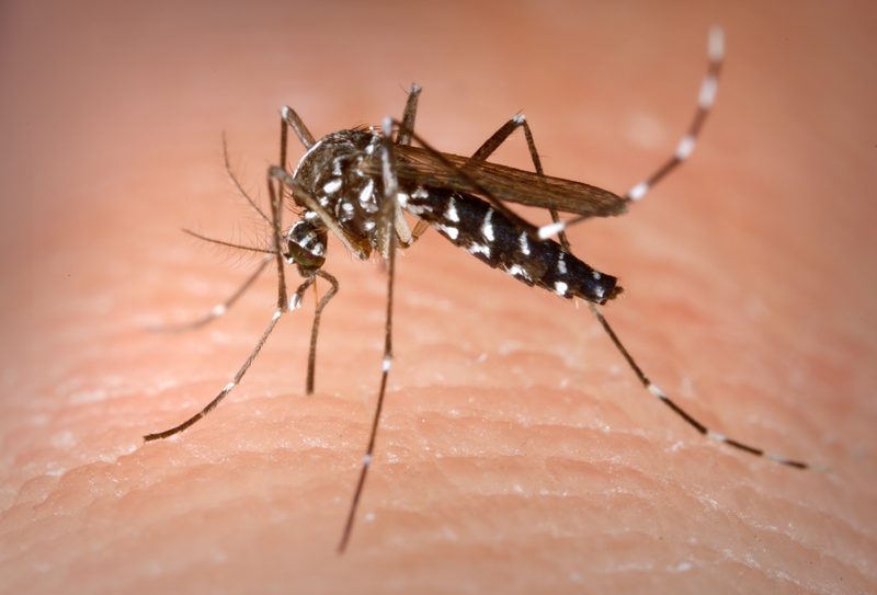
The story of Ae. albopictus in West Virginia is one of the faster range expansions recorded in the state. Established first in the Eastern Panhandle near the Washington DC metro, it has spread westward along the I-64 and I-79 corridors and is now confirmed statewide. The tiger mosquito breeds in discarded tires — still common in rural WV — and any small container holding water, making the state's outdoor culture particularly relevant: ATVs with water-collecting features, logging equipment, and rural porches all provide habitat. It bites throughout the day, catching people who think mosquitoes are only a dusk problem.

Aedes vexans mosquito photograph
Aedes vexans
Floodwater Mosquito

Responsible for the intense post-flooding biting that follows high water on the Ohio, Kanawha, and Greenbrier rivers — events West Virginia residents know well. The state's geography funnels heavy rainfall into sharp flooding pulses, and Aedes vexans eggs in the river floodplains respond explosively. The New River Gorge and Greenbrier River valleys see some of the most intense short-term surges, where the combination of forested terrain and flooding creates conditions that can make outdoor activity genuinely difficult for 10–14 days following a high-water event.

IV. West Virginia Cities at a Glance
CityPeak SeasonOff-SeasonNotes
Charleston Apr – Oct Off Nov–Mar Kanawha River; Elk River confluence; Ae. albopictus statewide; WNV some years Check live
Huntington Apr – Oct Off Nov–Mar Ohio River; Cabell County; similar to southern Ohio pattern; above-average pressure Check live
Morgantown May – Oct Off Nov–Apr Monongahela River; WVU campus; Culex pipiens; WNV detected in county most years Check live
Parkersburg Apr – Oct Off Nov–Mar Ohio River; Wood County; WNV active; Little Kanawha River corridor Check live
Wheeling Apr – Oct Off Nov–Mar Ohio River; Ohio County; northern border; one of highest WNV zones in WV Check live
More State Guides
Florida Year-round activity in the south — 80+ species including invasive Ae. aegypti and the Asian tiger mosquito across all 67 counties Texas ~85 species across four climate zones — Gulf Coast active March through November, with year-round pressure in the Rio Grande Valley California Central Valley is the #1 West Nile corridor in the US — invasive Ae. aegypti and Ae. albopictus now established in 20+ counties Georgia Atlanta metro leads the Southeast in Asian tiger mosquito density — active statewide March through November New York Ground zero for West Nile in the US (1999 Queens outbreak) — NYC metro and Long Island see the highest Northeast seasonal pressure Illinois Home of the 2002 Cook County West Nile outbreak — the deadliest urban WNV event in US history — peak season June through September Ohio Lake Erie to the Ohio River — WNV active in Franklin and Cuyahoga counties, with floodwater species surging after summer storms Pennsylvania Philadelphia WNV corridor meets rural EEE risk in western PA — the densest human population in the mid-Atlantic mosquito belt Michigan Site of the 2019 EEE outbreak — the deadliest in decades — 10 human cases and 6 deaths concentrated in SW Michigan Great Lakes wetlands New Jersey Oldest organized county mosquito control in the US (1914) — Pine Barrens EEE corridor and fierce salt marsh Shore species Virginia Tidewater season runs April–October — the longest mid-Atlantic window — with the Great Dismal Swamp as an active EEE hotspot North Carolina The coastal plain runs one of the longest seasons in the Southeast — NC leads the nation in La Crosse encephalitis cases from the Appalachian foothills Maryland Chesapeake Bay watershed creates extraordinary mosquito habitat — tidal marshes, Eastern Shore wetlands, and the DC-Baltimore corridor combine for dense seasonal pressure Tennessee Memphis and the Mississippi River corridor historically record the highest WNV case counts in the mid-South — Ae. albopictus has colonized all 95 counties Indiana Indiana sits at the crossroads of the Great Lakes EEE belt — Lake Michigan wetlands in the north and the Wabash River floodplain drive intense seasonal pressure Louisiana The Gulf Coast's most intense pressure — coastal marshes and summer rains keep Cx. quinquefasciatus and Ae. aegypti active from March through November Alabama Mobile Bay to the Tennessee Valley — Ae. albopictus has reached all 67 counties and peak WNV season runs June through September South Carolina Low Country marshes produce some of the Southeast's densest Anopheles and Culex populations — season runs March through November Minnesota 10,000 lakes means 10,000 breeding sites — the Northwoods sees intense but short July–August peaks, while the Twin Cities face a longer June–September window Wisconsin Great Lakes wetlands and the Mississippi River backwaters drive strong WNV pressure in the Milwaukee corridor — peak season July through August Missouri At the confluence of the Missouri and Mississippi rivers — St. Louis historically ranks among the highest WNV cities in the US — season May through October Arkansas Delta rice-field flooding and the Arkansas River bottomlands create some of the highest rural mosquito pressure in the mid-South — active April through October Washington Western WA stays mild and damp year-round; the Yakima Valley and Columbia Basin face the highest WNV risk in the Pacific Northwest — peak July through September Arizona Monsoon season (July–September) drives sudden mosquito explosions across the Valley of the Sun — WNV detected annually Colorado Front Range WNV corridor stretches Denver to Fort Collins — eastern plains carry the state's highest risk Connecticut Connecticut River valley WNV pressure meets EEE risk in inland freshwater wetlands — active May through October Delaware Chesapeake and Delaware Bay marshes create outsized pressure for the nation's second-smallest state Hawaii Year-round activity at sea level — no native species, but Ae. aegypti and tiger mosquitoes established statewide Idaho Snake River Plain irrigation districts fuel summer WNV pressure — season June through September Iowa Mississippi River corridor and prairie wetlands drive intense June–September pressure — WNV active statewide Kansas Great Plains WNV corridor — Wichita and Kansas City see peak pressure July–August; floodwater species surge after storms Kentucky Ohio River corridor and Kentucky Lake wetlands sustain a long April–October season across all 120 counties Maine Short but intense July–August season — EEE detected in some years in the southern coastal plain Massachusetts EEE fatality rate exceeds 30% — the Plymouth County swamp complex is the active epicenter — season May through October Mississippi Gulf Coast near-year-round pressure meets Delta rice-field flooding for one of the South's most intense mosquito environments Montana Yellowstone and Missouri River corridors drive a compressed June–August season — WNV detected most years in eastern MT Nebraska Platte River valley and eastern Nebraska are among the Great Plains' most active WNV zones — peak July–August Nevada Las Vegas monsoon season drives July–September activity; Reno irrigation districts fuel a parallel northern peak New Hampshire EEE detected most years — the southern lakes and coastal plain are in the active Northeast EEE corridor New Mexico Monsoon season (July–September) creates sudden breeding habitat; WNV circulates in the Rio Grande valley annually North Dakota Red River Valley flooding produces some of the Great Plains' most extreme floodwater mosquito events — peak June–August Oklahoma One of the South-Central's most intense seasons — the Arkansas and Red River corridors sustain populations April through October Oregon Eastern Oregon Columbia Basin is the state's WNV hotspot; western Oregon runs a mild coastal season June through September Rhode Island New England's densest coastal pressure — Narragansett Bay salt marshes and WNV active in all five counties South Dakota Missouri River and James River valleys drive summer WNV activity — eastern SD sees the most intense pressure Utah Salt Lake Valley WNV corridor and irrigation districts sustain a July–September peak — drier areas see limited activity Vermont Champlain Valley runs Vermont's longest season — EEE detected in the Lake Champlain lowlands in some years Wyoming The shortest meaningful season of any contiguous US state — North Platte valley WNV window is just 6–8 weeks
West Nile, dengue, and EEE: US disease risk by region → Asian tiger mosquitoes: why you're getting bitten during the day → Eliminating standing water: the highest-leverage yard move →