Is it mosquito season in Colorado?
Denver sits at 5,280 feet — the Mile High City — and still records West Nile Virus cases every summer. That's the Colorado paradox: a state most associated with altitude and outdoor recreation has a genuine, persistent WNV problem along its Front Range urban corridor. The reason is the South Platte River system, which threads irrigated agriculture through the Denver metro and provides Culex tarsalis with productive warm-water habitat within miles of 3.5 million people. East of the Front Range, the high plains amplify that risk considerably — the agricultural counties along the South Platte, Republican, and Arkansas rivers rank among the Mountain West's most active WNV zones most years.
The Front Range corridor: altitude doesn't protect you
Denver, Aurora, Lakewood, and Fort Collins all lie along a narrow band where the Great Plains meets the Rockies — and where Culex tarsalis finds the warm agricultural water it needs. The South Platte River corridor through Greeley and Brighton is the primary breeding engine for the metro, with irrigation return flows sustaining populations through the dry summer months when the river would otherwise run low. Arapahoe and Adams counties record the metro's highest WNV case totals most years. Fort Collins — home of Colorado State University's arthropod-borne disease research — runs detailed surveillance that makes its county data among the most carefully tracked in the region.
The eastern plains: Colorado's highest-risk zone
Drive two hours east of Denver and the landscape flattens into some of the most intensively irrigated farmland in the West. Weld County — one of the nation's top agricultural producers — sustains Culex tarsalis populations through the summer on a scale that dwarfs the metro. Morgan, Logan, and Yuma counties along the South Platte, and Otero and Prowers counties along the Arkansas River, routinely record WNV cases at rates that, adjusted for population, rival the worst of Kansas and Nebraska. The birds, the warm water, and the heat are all there.
Mountain communities: the genuine respite
Above roughly 7,000 feet, meaningful mosquito activity drops sharply. Summit County, Pitkin County (Aspen), and the mountain resort communities sit at elevations where cold nights prevent larvae from completing development reliably. Boulder — at 5,430 feet with significant creek and reservoir habitat — occupies an intermediate zone: more exposure than the mountains, but measurably less than the plains. The rule of thumb holds: every thousand feet of elevation gain shortens the season by roughly two weeks.
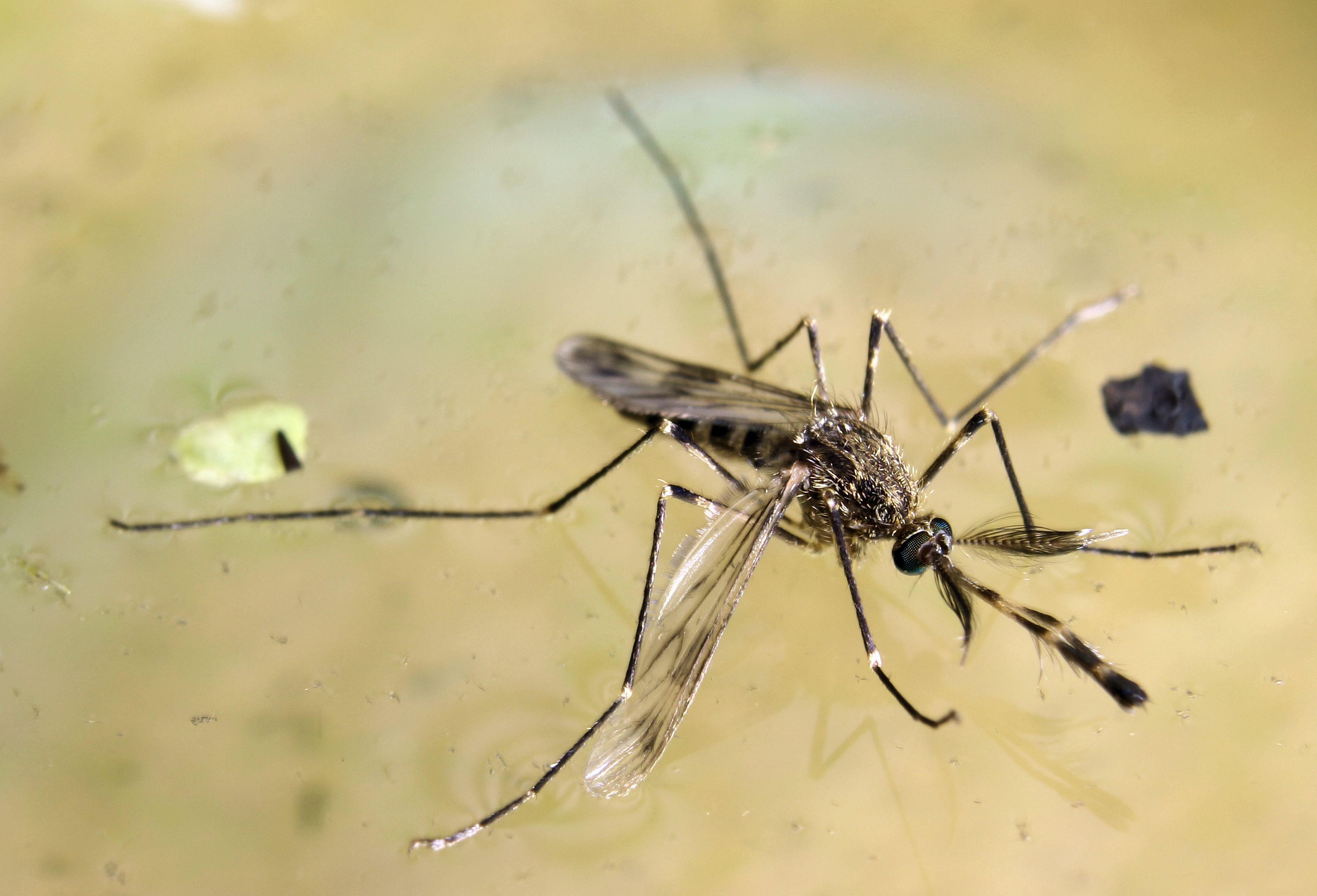
Colorado's primary WNV vector and the reason the Front Range has a mosquito problem despite its altitude. Culex tarsalis is built for the irrigated agricultural West — warm, slow, nutrient-rich water is what it needs, and the South Platte and Arkansas irrigation infrastructure delivers exactly that. Peak transmission occurs when July and August temperatures push above 80°F and the avian host population is concentrated near water. Weld and Arapahoe counties are the state's most consistently active zones for this species.
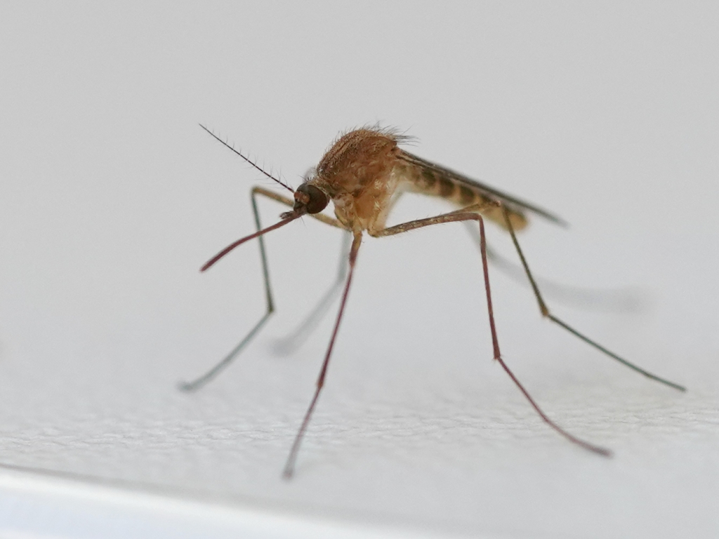
The urban counterpart to Culex tarsalis in Denver, Fort Collins, Colorado Springs, and Pueblo. Culex pipiens exploits the city — storm drain catch basins, neglected gutters, birdbaths, and the slow reaches of urban creeks provide breeding habitat that tarsalis avoids. A secondary but real WNV vector in Colorado's metropolitan areas, most active in residential neighborhoods dusk to dawn from July through September.
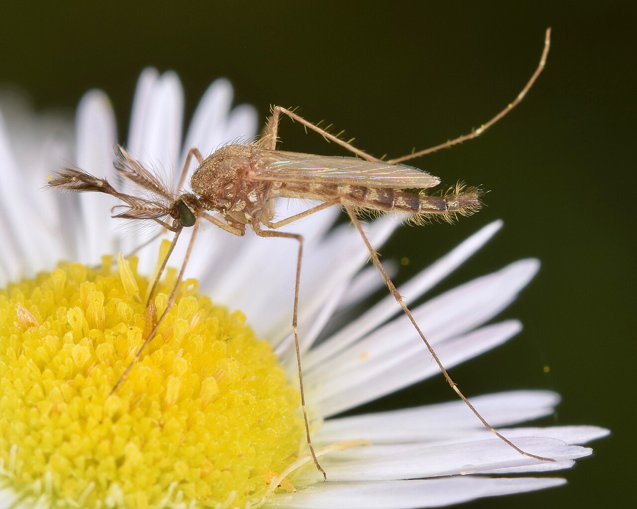
Responsible for most of the intense but brief biting that follows the South Platte and Arkansas River flooding events in late spring and early summer. Aedes vexans eggs in Colorado's river floodplains can hatch en masse after snowmelt events, producing biting pressure that peaks sharply and then subsides as water recedes. Annoying but a minor disease concern compared to the Culex species it accompanies.
| City | Peak Season | Off-Season | Notes | |
|---|---|---|---|---|
| Denver | Jun – Sep | Off Oct–May | South Platte corridor; WNV active most summers; Cherry Creek and urban retention ponds | Check live |
| Colorado Springs | Jun – Sep | Off Oct–May | Lower elevation than Denver; Fountain Creek corridor; follows Front Range pattern | Check live |
| Aurora | Jun – Sep | Off Oct–May | Eastern metro; Cherry Creek Reservoir area; higher exposure than western suburbs | Check live |
| Fort Collins | Jun – Aug | Off Sep–May | Cache la Poudre River corridor; shorter season; CSU vector research area | Check live |
| Pueblo | May – Sep | Off Oct–Apr | Arkansas River; earlier start than Denver; warmer microclimate extends season | Check live |