Is it mosquito season in Montana?
Montana's mosquito story splits cleanly at the Continental Divide. East of the Rockies, the Yellowstone and Missouri River agricultural valleys carry genuine West Nile Virus pressure every summer — Culex tarsalis is well-established in the irrigated grain and livestock country of Yellowstone, Custer, and Richland counties. West of the divide, the Bitterroot, Clark Fork, and Flathead valleys run a cooler, wetter season dominated by floodwater species — intense biting, but lower disease risk. The season everywhere is compressed: six to eight weeks of real activity centered on July, bookended by hard frosts.
Eastern Montana: the WNV corridor
Billings and the Yellowstone River valley are Montana's West Nile ground zero. Culex tarsalis breeds in the warm irrigation return flows, stock ponds, and river backwaters that define this agricultural landscape from June through August. Yellowstone, Carbon, and Custer counties record the state's most consistent human WNV cases — in active years, per-capita rates rival the worst of the Great Plains. The Bighorn River valley south of Hardin adds additional pressure from the dense riparian habitat along one of Montana's most productive trout rivers.
The Missouri River valley: Great Falls to the Badlands
The upper Missouri corridor — from Great Falls east through Havre, Wolf Point, and the Fort Peck Reservoir — produces significant floodwater mosquito events following spring snowmelt. The Charles M. Russell National Wildlife Refuge's 1.1 million acres along the Missouri creates extensive wetland habitat that sustains populations well into July. WNV is detected along this corridor in most active years, with Culex tarsalis the primary culprit in the agricultural reaches.
Western Montana: cooler valleys, different species mix
Missoula and the Bitterroot Valley experience a season that runs wetter and slightly cooler than the east — meaningful activity from late May through mid-August, driven primarily by Aedes vexans surges after the Clark Fork and Bitterroot River peaks. Flathead Lake and the Glacier Park area see some of the state's most intense short-term nuisance pressure in late June, when snowmelt loads the lowland wetlands simultaneously. West Nile detections west of the divide are less consistent than the east, but not absent — particularly in the warmer years.
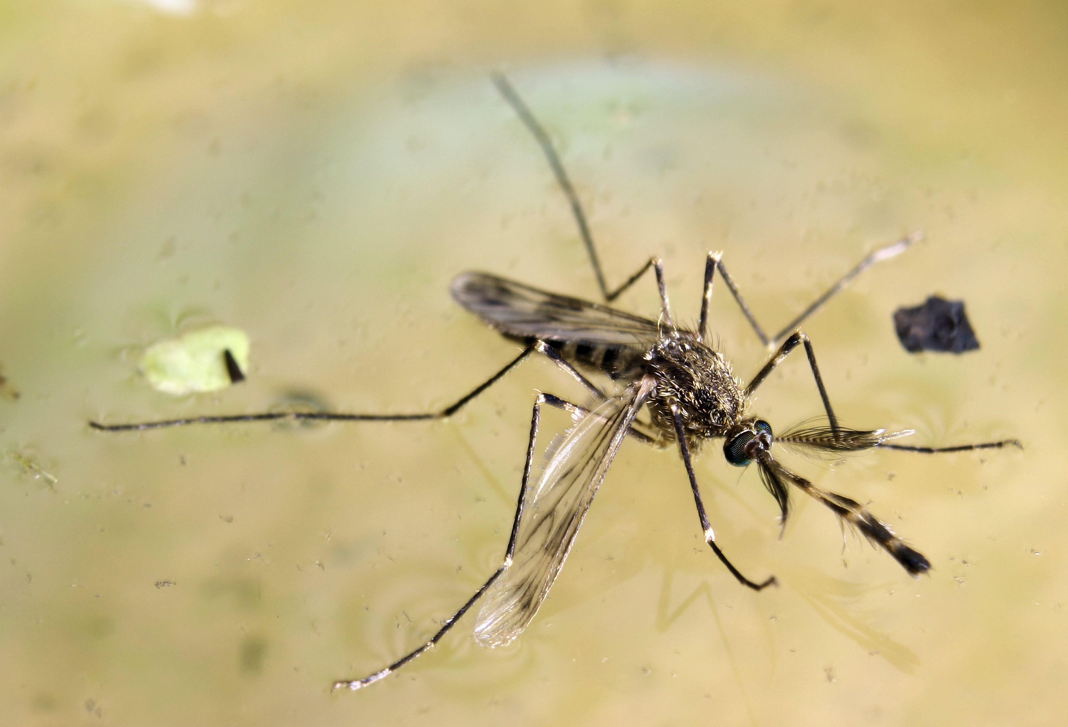
Montana's primary West Nile Virus vector and the species that makes the eastern agricultural valleys genuinely risky. Breeds in warm, slow water — irrigation ditches, stock ponds, and Yellowstone River backwaters. Activity peaks in the narrow July–August window, with WNV transmission accelerating when temperatures stay above 70°F overnight. In a warm year, Yellowstone County can see case totals that match much larger Midwestern metros.
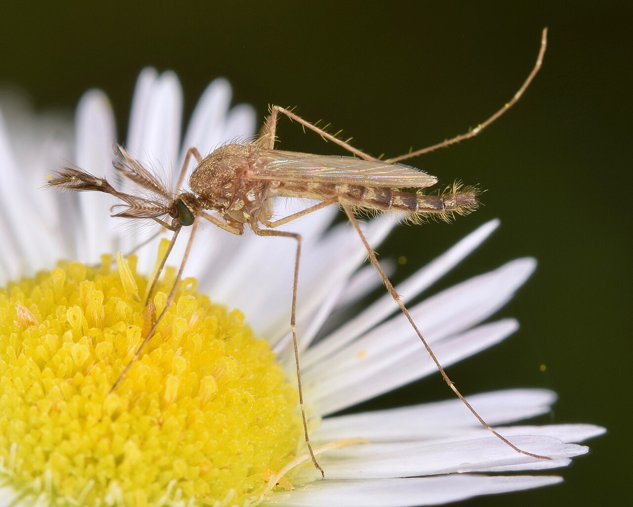
The species responsible for the sudden, overwhelming biting that Montana residents know from June camping trips. Aedes vexans eggs overwinter in floodplain soils across every major river drainage in the state and hatch in unison when spring flooding recedes. The Clark Fork, Yellowstone, and Missouri corridors all produce sharp early-summer surges that can make outdoor activity genuinely miserable for 10–14 days before populations stabilize.
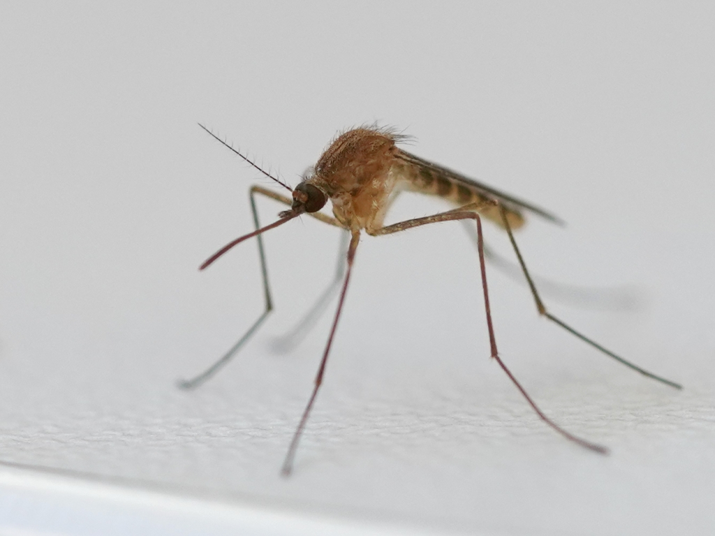
Present in Billings, Missoula, Great Falls, and the Flathead Valley. Less significant than Culex tarsalis as a WNV vector in Montana's agricultural context, but the dominant species in urban storm drain systems. Bites dusk to dawn through the July–August window, with populations concentrated near city parks and residential areas with standing water.
| City | Peak Season | Off-Season | Notes | |
|---|---|---|---|---|
| Billings | Jun – Aug | Off Sep–May | Yellowstone Valley; primary WNV zone; Culex tarsalis active most summers | Check live |
| Missoula | Jun – Aug | Off Sep–May | Clark Fork River; wetter western MT; shorter season; Ae. vexans dominant | Check live |
| Great Falls | Jun – Jul | Off Aug–May | Missouri River; irrigated farmland; intense but very short peak window | Check live |
| Bozeman | Jun – Jul | Off Aug–May | Gallatin River corridor; higher elevation; shortest season in SW Montana | Check live |
| Helena | Jun – Aug | Off Sep–May | Missouri River headwaters; moderate pressure; similar to Great Falls pattern | Check live |