Is it mosquito season in South Dakota?
South Dakota consistently ranks among the nation's worst states for West Nile Virus on a per-capita basis — a product of its outdoor culture, sparse population, and the remarkable Culex tarsalis breeding productivity of the James River valley and Prairie Pothole Region. The eastern part of the state is significantly more active than the Black Hills west, which offers genuine relief at higher elevations.
The James River valley: SD's WNV core
The James River — running north from the Nebraska border through Mitchell, Huron, and Aberdeen — is the spine of South Dakota's mosquito and WNV activity. The river's oxbow lakes, wetland margins, and adjacent prairie potholes sustain enormous Culex tarsalis populations through July and August. Beadle (Huron) and Brown (Aberdeen) counties regularly record some of the highest WNV rates in the country on a per-capita basis.
Sioux Falls and the Minnesota border counties
Minnehaha County (Sioux Falls) and the southeastern border counties draw pressure from the Big Sioux River watershed and numerous prairie wetlands. Sioux Falls is a larger metro context but still records consistent WNV cases annually. The city runs an active mosquito abatement program but the surrounding agricultural landscape means significant pressure regardless.
Western South Dakota: Black Hills relief
West of the Missouri River, mosquito pressure drops significantly. The Black Hills at 4,000–7,000 feet offer genuine low-mosquito conditions in June and July. Rapid City in the valley below sees some activity but far less than eastern SD. The Pine Ridge and Rosebud reservation communities on the mixed-grass prairie see moderate July–August pressure similar to the Nebraska panhandle.
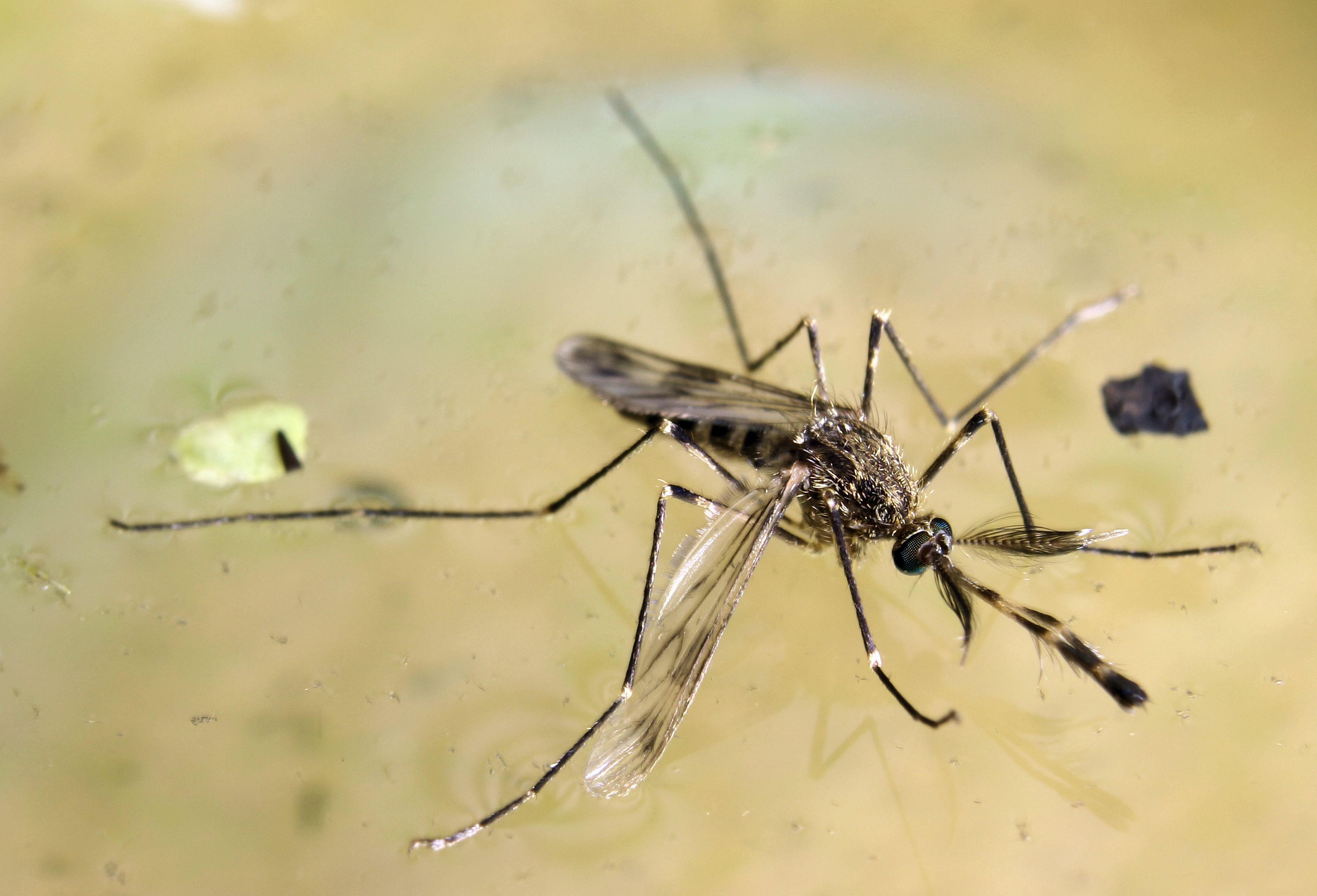
The species that makes South Dakota a perennial top-ten WNV state despite its small population. Culex tarsalis thrives in the prairie pothole landscape of eastern South Dakota — the glacially formed wetlands of Beadle, Spink, and Brown counties provide warm, productive breeding water through the summer that sustains populations capable of high-intensity WNV amplification. The James River valley, running 200 miles north to south through the heart of the state, functions as a continuous corridor of tarsalis habitat. South Dakota's per-capita WNV case rates in active years (2003, 2012, 2022) have ranked among the highest in the nation — a direct product of this species' productivity in prairie pothole country.
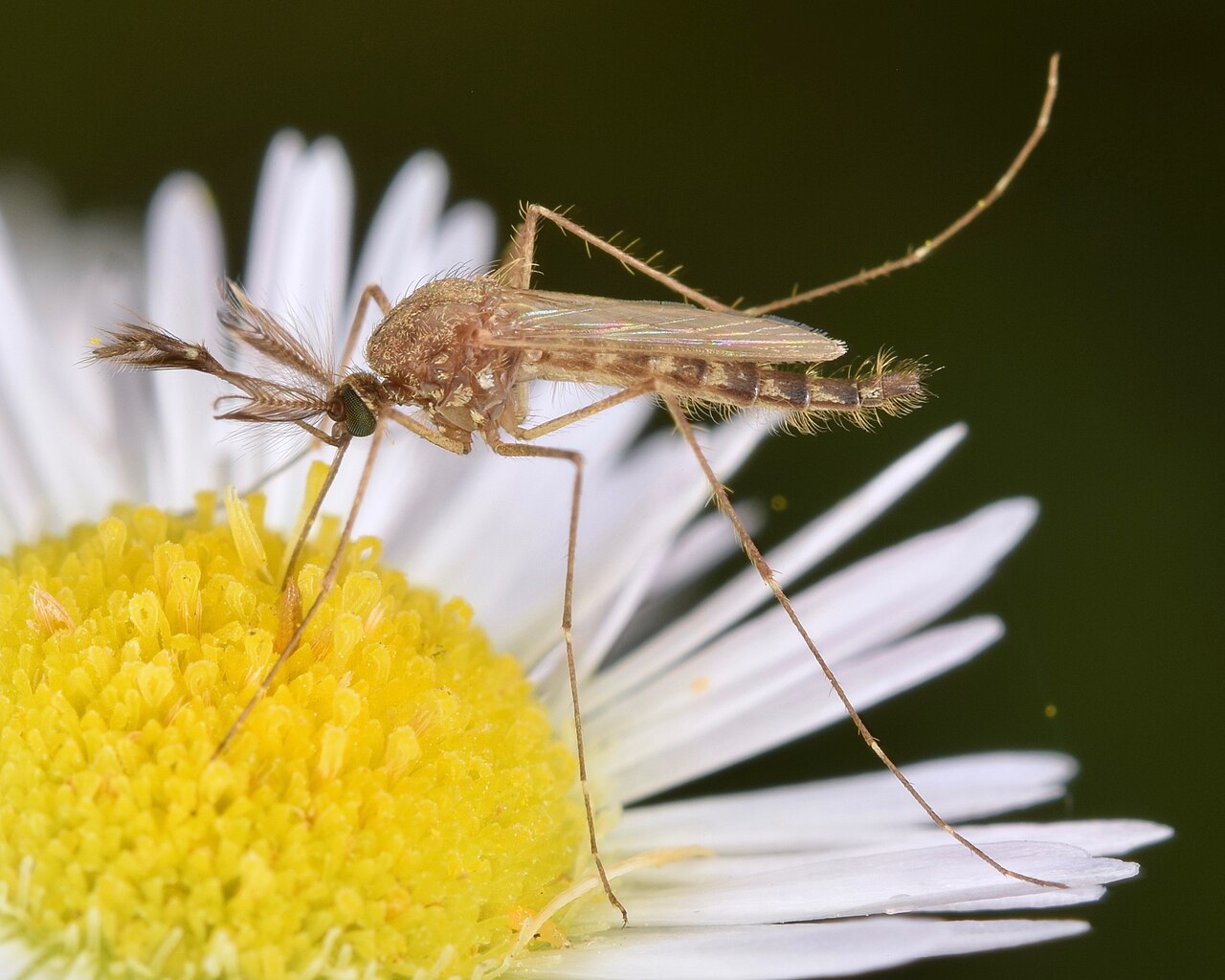
South Dakota's most visible mosquito — the one that arrives in waves after spring snowmelt floods the Big Sioux, James, and Missouri River bottomlands. Aedes vexans populations in the eastern part of the state can surge dramatically in late May and early June, producing the intense outdoor pressure that defines South Dakota spring for residents near river corridors. The Missouri River's managed flows from the Oahe and Francis Case reservoirs produce a more predictable seasonal pattern than the rain-driven floods of the eastern prairie, but both trigger the same explosive hatching response.
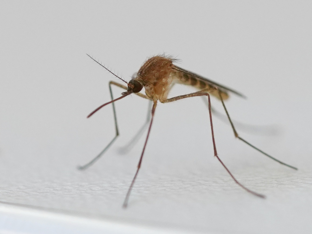
Present in Sioux Falls and Rapid City — the urban WNV vector complementing Culex tarsalis in South Dakota's two largest cities. Minnehaha County (Sioux Falls) runs mosquito abatement targeting both species, recognizing that pipiens in the city and tarsalis in the surrounding agricultural Big Sioux River floodplain together drive the county's WNV exposure. In Rapid City, pipiens is less significant than in the east — the drier Black Hills microclimate limits storm drain breeding — but the species is present and active through the July–August window.
| City | Peak Season | Off-Season | Notes | |
|---|---|---|---|---|
| Sioux Falls | Jun – Sep | Off Oct–May | Big Sioux River; Minnehaha County WNV active; metro abatement program | Check live |
| Rapid City | Jun – Aug | Off Sep–May | Black Hills foothills; lower pressure than eastern SD; Rapid Creek corridor | Check live |
| Aberdeen | Jun – Aug | Off Sep–May | James River; Brown County among highest per-capita WNV in US; pothole country | Check live |
| Brookings | Jun – Aug | Off Sep–May | Big Sioux headwaters; prairie potholes; Brookings County WNV active most years | Check live |
| Watertown | Jun – Aug | Off Sep–May | Lake area; Codington County; pothole-driven WNV pressure | Check live |